EZPONDAStability of coastal slopes in the Basque region
Involved Teams : IVS, GS, PHT
Permanent Staff involved : D. Morichon (IVS), S. Abadie, P. Maron (IVS), B. Larroque (PHT), C. La Borderie (GS), C. Bascoules-Perlot (GS)
Post Doc : F. Bellafont (IVS), A. Cuccurullo
The research project EZPONDA (cliff in Basque) carried out by the Community of the Basque Country is interested in the characterization and modeling of the mechanical and chemical processes that cause the alteration of cliffs and the damage of defense works. The project is 65% co-financed by ERDF funds within the framework of the Operational Program "ERDF ESF 2014-2020" led by the New Aquitaine Region.
The project, which runs from 2019-2022, involves actors from the GIS Littoral Basque and national research organizations (CNRS, Shom, CEREMA, BRGM) as well as university laboratories specialized in the study of coastal issues from the universities of La Rochelle, Toulouse, Pau and Pays de l'Adour. Research collaborations are also formalized with the national observation network DYNALIT in order to strengthen scientific observation of the Basque coast. Technical partnerships are finally established with the Departmental Council 64 and the topographer-geometer students of the Cantau High School.
The complementary nature of the SIAME teams involved in this project allows an original, multidisciplinary approach to the problem of cliff stability and damage to structures on the various project workshop sites.
Workshop sites of the EZPONDA project
Sites of the cliffs of Bidart and the Corniche.
The scientific literature highlights the fact that the erosion of the coastal cliffs is due to the action of several climatological and oceanographic processes that should be observed simultaneously. The rate of cliff retreat is relatively low along the Basque coast, in the order of 20 to 30 cm per year. However, following intense rainfall events, local retreat of several meters can be observed. The interactions between partial saturation of the soils and their geological heterogeneity can lead to a complex evolution of the safety factor. In order to understand these phenomena, the SIAME teams are interested in the complete mechanical characterization of the material, i.e. the determination of the rigidity and mechanical strength, for different levels of capillary tension and shear stress. The objective of this work is to develop a coupled hydromechanical model describing the behaviour of the real slope by simulating the geological characteristics and soil properties based on on-site measurements.
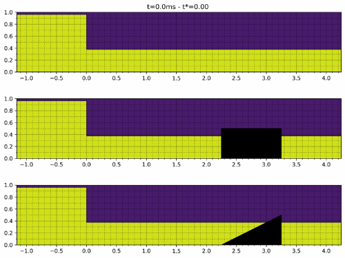
Wave action is also a parameter that can participate in the triggering of landslides by exerting critical mechanical stresses at the foot of the cliff during extreme energy events concomitant with high tidal levels. To study these processes, SIAME carries out numerical simulations with a RANS code (NOTUS in collaboration with UMR I2M) in order to quantify the energy dissipation rate induced by the macro-roughnesses present on the rocky plain. In parallel with this work, an autonomous video station will be installed at the top of the Socoa fort (collaboration with GET) to follow the transformation of the waves on the rocky plain and their interaction with the cliff. This monitoring system will be completed by a hydrodynamic measurement campaign scheduled for autumn 2021. The long-term objective of this work is to improve Boussinesq-type wave models to predict wave-induced stresses on the cliffs during extreme events and to estimate the effect of sea level rise on wave/cliff interaction processes.
RANS (NOTUS) simulation of the interaction between hydraulic jump and a macro-roughness
(CLICK ON PHOTO TO ZOOM AND ANIMATE)
Site of the Artha dike
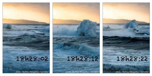
An autonomous impact pressure measurement device was developed in collaboration between SIAME teams to record the impact pressures exerted on the dike deck for different incident wave conditions and water levels. At the same time, an autonomous inertial unit fixed on blocks protecting the shell is being developed to monitor their movement during storms. The objective of these measurements is to determine the wave regimes at the origin of block displacements and masonry damage. The data collected during the project will be completed with the results of a wave-resolution model to study the influence of wave characteristics (significant height, period, direction) on the stability of the structure.
Digue de l'Artha - Expulsion of a 50t block during a storm


